
Appleton Previous Resident Sources
Start with the source closest to the date being studied. Current tax and deed records establish the land and named owners. Printed directories and released census schedules add household evidence for past residents. Maps and permits describe the structure rather than the people. Newspapers, obituaries, and probate can explain why a name leaves the address trail.
| Source | Years It Covers | Where Held | What It Shows |
|---|---|---|---|
| Recorded deeds | Online start not confirmed | LandShark and Register of Deeds | Transfer parties, date, document placement, legal description |
| Appleton directories | 1874 first year; digitized 1884–85, 1901, 1904, 1915 | APL and Appleton Memory Project | Listed occupant, work, address, home notation |
| Directory bibliography | 1884–1919 listed | College Avenue historic-district record | A source trail, not proof every annual volume survives |
| Federal census | Released schedules through 1950 | NARA and library databases | Household names, ages, relations and locality |
| Tax and assessment | Bills from 2010; phone data to 1982 | Ascent, Treasurer and Open Data | Owner, mailing address, values and tax history |
| Newspapers | Microfilm from 1853; other runs vary | APL and archive databases | Notices, moves, deaths and civic activity |
| Sanborn maps and permits | Exact map and permit runs not confirmed | APL Jabas Collection and city custodian | Building footprint, use, work and dates |
The deed chain is best for owners. A directory or census is better for who lived here before. Neither is complete. Keep the record date beside every name, and label gaps instead of stretching one result across several years.
Freeze the Appleton Parcel First
Preserve the full modern address, then run it through Outagamie County Ascent. Search by street number and plain street name, using one category at a time. Copy the red parcel-number result, legal description, situs address, current owner, mailing address, tax year, and any lot, block, or subdivision reference. Those fields form the stable starting packet for previous-resident research.
Next open City or County GIS. Confirm the parcel shape and inspect address points, city limits, adjacent lots, historic aerials, zoning, and neighborhood context. A mailing address is where tax notices go, not proof that the owner occupies the parcel. The situs address is the physical property location. Keeping those fields separate prevents a false household claim.
Trace Appleton Owners Through Deeds
The deed chain follows recorded transfers, one at a time. Use the present owner and legal description from Ascent to find the acquisition deed in Outagamie County's LandShark system. Save every document number or volume and page. The county does not perform the title search for a requester, so the researcher must keep the sequence and resolve name variants.
- Confirm the current owner, parcel ID, and full legal description in Ascent.
- Find that owner's purchase instrument by searching the owner as grantee.
- Copy the grantor, grantee, recording date, document number, and legal description.
- Search the seller as a grantee to locate that person's earlier purchase, then repeat.
- When the online trail ends, use the Register of Deeds counter, mail request, books, or another lawful custodian route.
- Grantor and grantee
- The grantor gives an interest in property; the grantee receives it.
- Chain of title
- The ordered series of recorded transfers for the same land.
- Legal description
- The lot, block, subdivision, or survey wording that identifies land even when its street number changes.
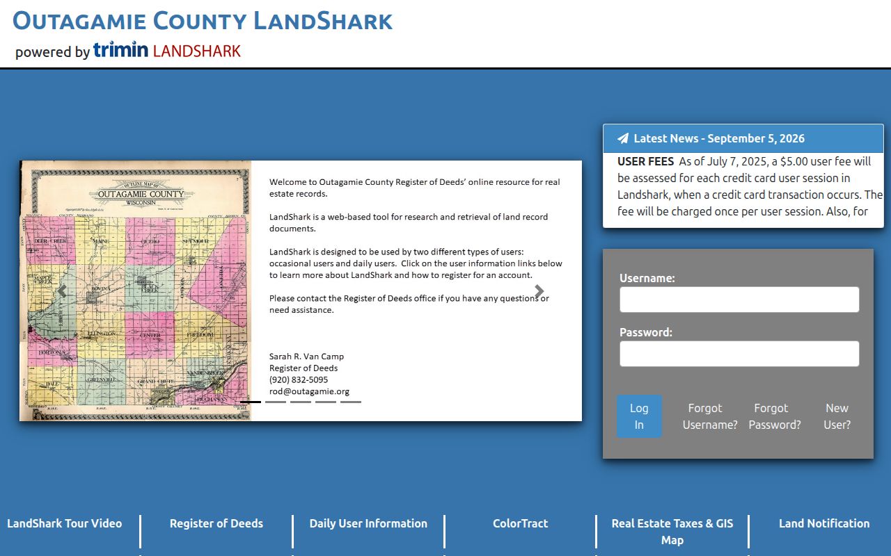
The LandShark portal is the online entry point for this recorded-document search.
Its exact online cutoff was not verified. Counter staff can print real-estate copies while a requester waits. Mail requests should provide a document number or volume and page. Copies cost $2 for the first page and $1 for each additional page, with added charges for plats or certification.
Appleton Previous Residents by Era
Appleton's first city directory appeared in 1874. Digitized anchors survive for 1884–85, 1901, 1904, and 1915. A historic-district bibliography lists directory sources from 1884 through 1919, but it does not prove that every annual volume survives. The 1915 directory spans Calumet, Outagamie, and Winnebago counties, which helps when a person's work and home crossed local boundaries.
These dates offer checkpoints, not continuous residence. An entry may identify a head of household, employee, telephone subscriber, or business while omitting others. The Jabas Appleton Collection may hold more physical and reverse directories, but its complete run and last printed year were not confirmed online. Ask library staff about the exact year needed.
Map an Old Appleton House
The Appleton Public Library's Jabas Collection holds Sanborn Fire Insurance Maps, plat maps, city directories, photographs, local-history books, and more than 1,500 rolls of Appleton newspapers reaching back to 1853. Sanborn maps can show a building footprint, use, and address context. They do not name residents. Exact Appleton Sanborn volume years were not published in the captured page, so check the shelf, catalog, or Library of Congress metadata before claiming coverage.
The Appleton Memory Project provides a visual index into digitized local material. A map, plat, and directory can bridge the same house across old street conventions. Compare neighboring names and cross streets, then return to the deed's legal description for proof of land continuity.
Bridge Appleton Address Changes
No confirmed Appleton street renumbering or renaming year was located. That gap must stay visible. Early directory entries may use a side-of-street mark, a cross street, or phrases such as “1 n. 3d.” Modern Ascent, by contrast, expects a stripped street name. A direct number match across those systems may be wrong.
Use the parcel's legal description, recorded plat, historic map, cross street, building footprint, and nearby occupants as the bridge. Preserve the old text rather than silently converting it. If several clues agree, describe the match as supported by those records. If they conflict, leave the identity unresolved.
Pair Appleton Directories and Census
Federal census schedules give household composition that a printed directory may omit. Released schedules are available through 1950 under the 72-year rule. Most 1890 population schedules were lost, so directory evidence is especially useful around that gap. Still, a directory is not a census substitute.
- Copy the directory entry exactly, including address, work, spouse notation, and home or residence marks.
- Search the closest released census by name and locality, then inspect the full household and nearby entries.
- Compare ages, relations, work, cross streets, and neighbors. Record spelling and address differences.
- Move to the next directory year to narrow when the household arrived or left.
- Use a deed, obituary, newspaper notice, church record, or probate file as independent support.
The detailed publishers, scans, and entry abbreviations belong to the Appleton city directory collection. For a previous-residents trail, use only the volumes that help date this one address.
Date Appleton Changes by Request
A permit can help date construction, an addition, or a major alteration. No verified public Appleton permit portal or online retention start was found. Submit a targeted city records request with the street address, parcel number, likely project type, and a practical date range. Ask for identifiable permits or inspection records, not for staff to solve the house history.
Wisconsin Public Records Law, Wis. Stat. §§ 19.31–19.39, supplies the general request route. Older material may remain only in office files. When no permit survives, compare tax-roll changes, historic aerials, Sanborn footprints, photographs, and newspaper notices, while stating that these sources are indirect.
Appleton Records Before Outagamie
Outagamie County's earliest record context reaches into predecessor-county books. The county board paid H. S. Eggleston to transcribe Outagamie references from Brown County records. That local detail explains why an old Appleton land trail may leave the present county sequence. A broken chain is not always a missing deed; the next reference may sit under an earlier county arrangement.
Carry the legal description and party names into that earlier search. Local-history repositories, the Wisconsin Historical Society, FamilySearch, and county custodians can help locate the relevant record group. Do not assume that a modern portal covers the county's full legal history.
Close Appleton Past Resident Trails
Ownership is only half the story. A directory may place a listed adult or business at an address for one publication year. A census can name a larger household. The Appleton Public Library's partial Obituary Index can then point to a full item on microfilm, and library staff offer a free article or obituary email service. Newspaper coverage varies by platform, so record the publication date and inspect the actual item.
An obituary may identify relatives, a death date, and a later place. A probate file held by the Outagamie Clerk of Circuit Court may name heirs, fiduciaries, or mailing addresses. Those addresses are tied to that case and date, not proof of a person's current residence. The History Museum at the Castle also holds manuscripts, family papers, government records, maps, directories, and more than one million photographs. Research there requires a form and an appointment at least one week ahead; service and commercial-copy fees apply.
When these sources agree on name, date, and place, they can explain who lived here before and when the household changed. When they disagree, preserve both versions.
Lawful use. Research Appleton previous residents for house and family history. Never use a record trail to track, harass, threaten, or harm a living person.