
Appleton Neighbors by Block
Public block research begins with land, not a list of people. Appleton and Outagamie County GIS show parcel shapes, addresses, street lines, city limits, and neighborhood labels. A linked tax card may name an owner and show situs and mailing addresses. Those facts help map nearby parcels around one address, but they do not prove who is inside each home.
| Source | What It Shows About a Block | Access |
|---|---|---|
| City Property Viewer | Parcel polygons and neighboring property context | Public map |
| Outagamie parcel GIS | Parcel ID, geometry, owner display, regional layers | Public map and REST query |
| City Address Points | Known street, unit, parcel, and structure points | Public GIS layer |
| City Neighborhoods | Community boundary and label | Public REST query |
| MyVote | Polling and election details for one address | Public lookup, not a block roster |
| APL directories | Past address-to-occupant or business entries | Library and digital collections |
An owner may get tax mail elsewhere. A renter or relative may not appear on a parcel card at all. Address points describe structures and units, not residents. The defensible result is a set of parcels and dated public attributes, with every field labeled by source.
Map Appleton Neighbor Parcels
Start at the target parcel in City or County GIS. Save the parcel ID and legal description, then zoom out until the touching polygons are clear. Turn on address points and street centerlines to distinguish corner lots, units, and rear structures. City limits and neighborhood layers add jurisdiction and community context.
- Find the address in Appleton GIS and confirm its parcel outline.
- Click each adjoining polygon and record parcel ID, situs address, owner display, and tax year.
- Open the tax card where available, then compare the physical situs address with the mailing address.
- Use LandShark only for a specific transfer, party, or legal-description question.
The flow is address to parcel, parcel to adjoining polygons, and polygon to tax card. The county REST service can return GeoJSON or PBF data but caps a response at 2,000 records, so narrow the area. For an entire named road, use the Appleton street directory method.
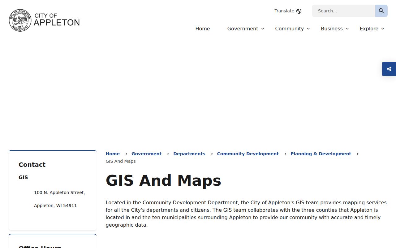
The map adds spatial context that an owner-name list cannot provide.
Layer Appleton Block Records
Each GIS layer answers a different question. Parcels show boundaries and IDs. Address Points hold known street, unit, parcel, and structure references. Street Centerlines carry names and address ranges. City Limits separates Appleton from a nearby town even when both use an Appleton postal label. Zoning, floodplain, historic aerial, LiDAR, and historic inventory describe land context, not households.
- Parcel
- A mapped tract tied to a tax ID and legal description.
- Situs address
- The physical address assigned to the parcel.
- Mailing address
- The destination for tax notices, which may be elsewhere.
- Neighborhood layer
- A mapped community label, not a membership list.
The City Neighborhoods service exposes FID, Shape, Id, and Neighborho fields and supports ordinary and distance-based queries. It does not contain a resident roster.
Appleton Neighborhood Map Labels
Appleton's GIS legend identifies Alicia Park, Ashbury Meadows, Colony Oaks, Downtown Neighborhood, Erb Park, Franklin, Historic Central, Lawrence-City Park, Old Third Ward, River Drive, Summit Park, West Appleton, and Windingbrook Watch. It also names Dellwood Street, Huntley Houses, Northland Downs, Peabody Park, Thornbrook Meadows, and W. River Road.
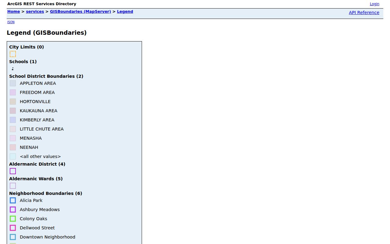
The legend supplies a verified area name. It does not show association members or every household within that boundary.
Appleton Civic Directory Contacts
Community directories identify public organizations without exposing private rosters. The verified local sources are civic and business contact lists. Watch maps can show program areas, while congregations, block clubs, and fraternal groups control their own records.
Downtown community
Appleton Downtown Inc. publishes events and civic-business contacts.
Fox Cities organizations
Fox Cities Chamber lists family, community, and civic organizations.
Neither source was verified as a full neighborhood association directory. Contact the organization directly and respect any limits on its member data.
The public coalition page is useful for finding a community contact, not for naming nearby residents.
Check Appleton Voter Addresses
MyVote's address mode asks for street address, unit, city, and ZIP. It returns polling place, ballot, election, and absentee information for that address. Name mode instead requires first name, last name, and birth date, then may show registration status, current election address, activity, and an active or inactive reason.
Neither mode produces everyone on a block. Wisconsin has no party-preference registration field, and activity does not reveal a ballot choice. Badger Voters offers broader geographic files through a paid request system, with My Wisconsin ID, multifactor authentication, legal use conditions, and protected-voter exclusions.
Trace Historic Appleton Blocks
Current parcel cards cannot answer who lived next door decades ago. Appleton Public Library's Jabas Collection holds city directories, plat maps, yearbooks, Sanborn maps, newspaper microfilm, and obituary indexes. Address and criss-cross sections can rebuild an old block, though abbreviations, missing years, and changed street conventions demand care.
Appleton historic districts add context around College Avenue, City Park, the Fox River paper works, locks, mills, and wire works. That setting may explain why a household appeared close to an employer, church, school, or civic group. It remains dated history, not proof about current residents.
The first Appleton city directory appeared in 1874. Surviving digital anchors include 1884-85, 1901, 1904, and 1915. The later volume spans Calumet, Outagamie, and Winnebago counties, so an old neighbor may be filed under an adjacent place rather than the city heading expected today. Search both the name section and the printed street section. Then compare the entry with a plat, census year, newspaper item, or obituary. A directory abbreviation such as “res.” or “h.” can be misread by optical character recognition, and side-of-street notes can fail in a text search. The library's free research session and microfilm scan or email help give Appleton researchers an offline route when the online text is incomplete.
The History Museum at the Castle adds maps, photographs, manuscripts, and organization records by advance appointment. Its holdings include more than 20,000 artifacts, 800 cubic feet of manuscripts, 2,000 volumes, 350 maps, and over one million photographs. These collections can place a block in its social and industrial setting, but they are not designed as a live resident index.
Compare Appleton Neighbor Sources
Official rolls and commercial neighbor tools have different strengths. County and city sources identify the custodian, field, and date. Commercial services merge public and purchased data, so stale addresses and same-name combinations are common. Use a commercial hint only to return to an original source.
| Source type | Strength | Main limit |
|---|---|---|
| City or county GIS | Mapped parcel and boundary context | Does not identify every occupant |
| Tax or deed record | Official owner or recorded party | Ownership is not current presence |
| Voter tool | Election-specific address facts | Protected data and no household roll |
| Commercial category | Broad hints across sources | Unknown refresh and probabilistic matches |
The official record should settle any conflict. Keep its date and avoid turning a weak association into a claim about who lives nearby.
Protect Appleton Resident Privacy
A block lookup cannot reliably show renters, all household members, utility subscribers, delivery records, DMV addresses, sealed court parties, or current physical presence. MyVote excludes confidential electors and protected judicial voters. Wisconsin Safe at Home can replace an eligible person's actual location with an assigned address and mail forwarding.
Use each fact only at the level it supports. A parcel owner is an owner of record. A mailing address is where notices go. A neighborhood polygon names a mapped area. When a record seems wrong or exposes protected data, contact its custodian about correction, redaction, or confidentiality.
Lawful use. Research the Appleton block for civic interest, reconnection, or personal awareness. Never use public data to stalk, harass, threaten, intimidate, or harm another person.